Bridge Clearance at Today's Tide, Not the Number on the Sign
Everyone just guesses. I did too.

THE SHORT ANSWER
The clearance on a chart or a bridge sign is measured from mean high water. The real gap changes with the tide. Clearance right now is the charted clearance plus however far the water sits below mean high water. Gillby works that out live for 97 bridges, so you can compare it to your air draft.
AT A GLANCE
- Charted clearance is measured at mean high water (MHW).
- Below MHW you have more room. Above it, during a king tide or surge, you have less.
- Gillby uses NOAA tide predictions plus the nearest live gauge when it passes checks.
- Add a margin to your air draft and still read the clearance board.
Why is the number on the sign not the whole story?
The clearance printed on a chart, and usually on the bridge, is the gap at mean high water. That is a long-term average high tide, not the water you are sitting on today.
At low tide you have more room than the sign says. At a big high tide, or a king tide with an onshore wind, you can have less. I could not find anything that put the tide at that moment together with the height of the bridge, so everyone just guesses.
How do you work out clearance at the tide right now?
The math is simple:
Clearance now = charted clearance at MHW + (MHW − water level now)
If the water is 1.5 ft below mean high water, you have 1.5 ft more than the chart says. If it is half a foot above, you have half a foot less.
Gillby gets the water level from NOAA CO-OPS tide predictions, referenced to MHW, at the harmonic station tied to each bridge. When a nearby live gauge is fresh and agrees with the others, Gillby adds how far the real water is running above or below the prediction. When no gauge passes, it says the number is prediction only.
A real example from tonight
Tonight had a strong northeast wind, and that pushes water up against the coast. Here is what that did to one low bridge in Boca.
- Type
- Bascule. Opens on the hour, :20 and :40
- Charted clearance, closed
- 9 ft at MHW
- Predicted tide
- 1.5 ft below MHW
- Live gauge
- Water running 0.8 ft above the prediction
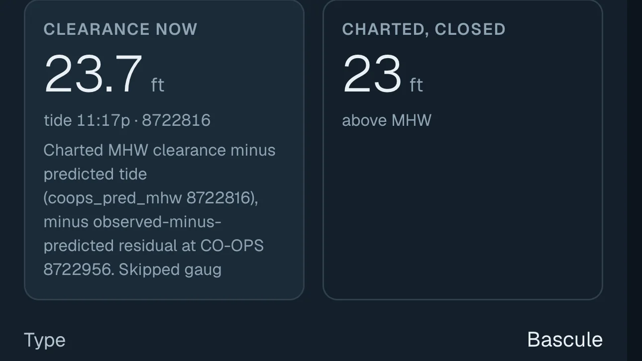
- Clearance from the prediction alone
- 10.5 ft
- Clearance now, with the live gauge
- 9.7 ft
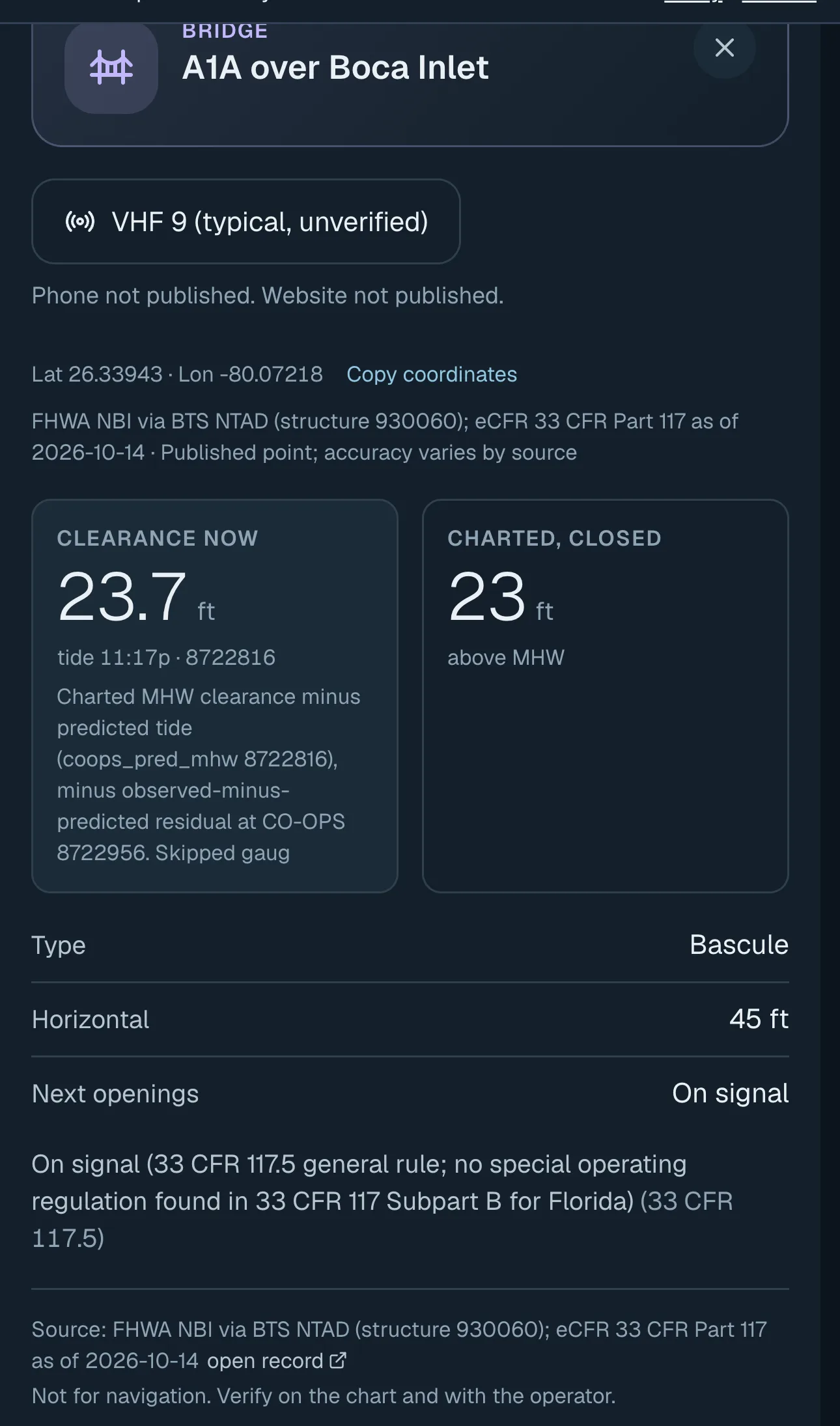
Read from Gillby at 11:18 PM ET, Sunday, October 18, 2026. Prediction from NOAA station 8722816 (Boca Raton). Live gauge: NOAA 8722956 (South Port Everglades), observed at 11:06 PM ET.
Say your boat needs 8.5 ft with the antennas down, and you want a foot of margin. That is 9.5 ft. The sign says 9 ft, so you would think no. The tide table alone says 10.5 ft, so you would think easy. With the water the wind piled up tonight it was 9.7 ft. It fits, but with a couple of inches instead of a foot.
That is the gap I kept guessing at.
How do I use it?
- Measure your air draft: waterline to the highest point, with the antennas and T-top as you will run them.
- Add a margin. Wakes and chop lift the boat.
- Tap the bridge on the water map to see clearance now, the charted number and the opening schedule.
- Planning ahead? Route checks look at bridges along the way for your departure time.
When you get there, read the clearance board on the bridge. If it is close, wait for an opening. I'm still learning this stuff, and the board is the final word.
Quick answers
What does bridge clearance at MHW mean?
It is the vertical gap between the water and the bottom of the bridge when the water is at mean high water, a long-term average high tide.
How do I calculate bridge clearance at the current tide?
Add the charted MHW clearance to however far the water is below MHW right now. If the water is above MHW, subtract the difference.
Which bridges does Gillby cover?
97 South Florida bridges, each with charted clearance, opening rules and a live clearance from NOAA tide data.
Can I trust the live number?
Use it to plan. Waves, surge and the station distance all matter, so read the clearance board and keep a margin.
Know the bridge before you get there.
Tap any bridge on the map for clearance at the tide right now.
Open the water mapSomething missing for your water? Tell me.