Public data. Original intelligence. Built for people and agents.
Our growing body of software, derived data and research for life on the water.
WHAT IS GILLBY LABS?
An open foundation. Our own intelligence above it.
Gillby Labs is our research and development studio for life on the water. We bring public data together, build new intelligence around it, and test how it can help people, apps and AI agents make better use of the coast.
250+
PUBLIC DATA STREAMS ARCHIVED
Weather, tides, buoys, satellite products, water quality and coastal records—brought into one connected foundation.
Archive snapshot · October 19, 2026. Counts include station-specific feeds and distinct data products, rather than separate agencies. Coverage and freshness vary.
SHARED FOR OTHERS TO BUILD ON
Tools we give away.
Open-source MCP and Water skill tooling, developer documentation, and public API access within published limits. A starting point for builders, schools, researchers and hobbyists.
Our proprietary scoring, forecast enrichment, vessel-aware estimates and connected experiences: choppiness and ride outlooks, personalized fuel and clearance tools, and the research behind them.
Public source data belongs to its providers. Open-source releases cover the tools we publish under their licenses; our hosted service, proprietary models and internal research remain separate. Availability and terms vary by tool.
OBSERVE / INTERPRET / PERSONALIZE / CONNECT
From the water. To intelligence.
PUBLIC SOURCESOne connected view.→ORIGINAL DATAScores. Context. Confidence.→YOUR VESSEL196 profiles. Your setup.→PEOPLE + AGENTSApp. API. MCP.
GILLBY LABS / ORIGINAL RESEARCH & DEVELOPMENT
Built beyond the data feed.
Public water data. Our own scores and vessel-aware tools. One connected layer for people, apps and AI agents. Explore the work behind Gillby.
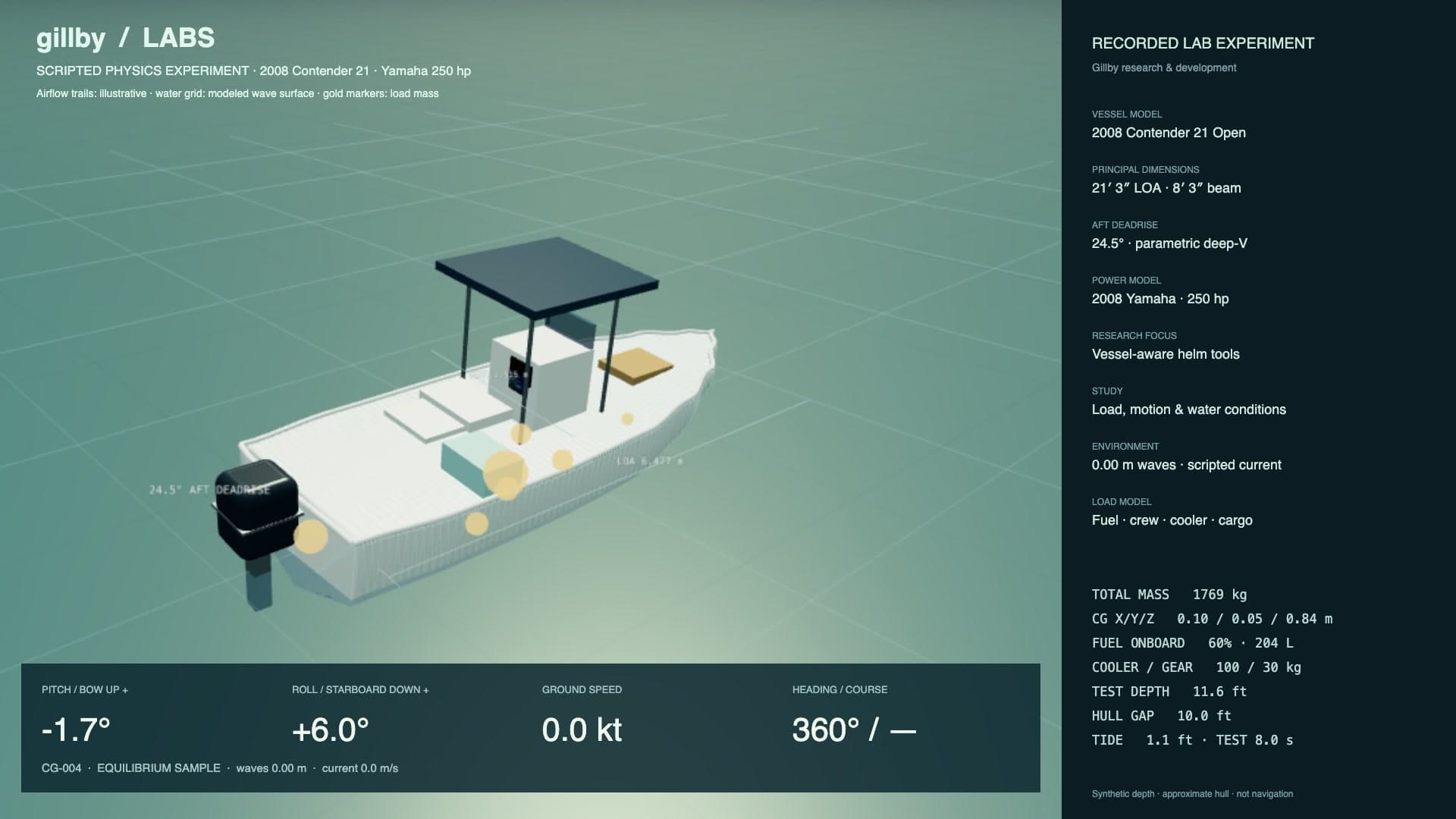
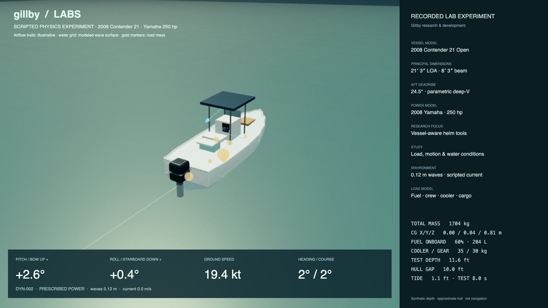
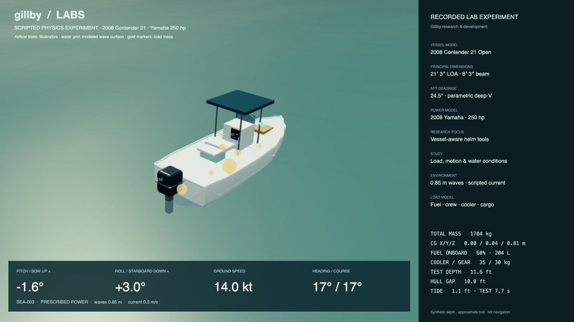
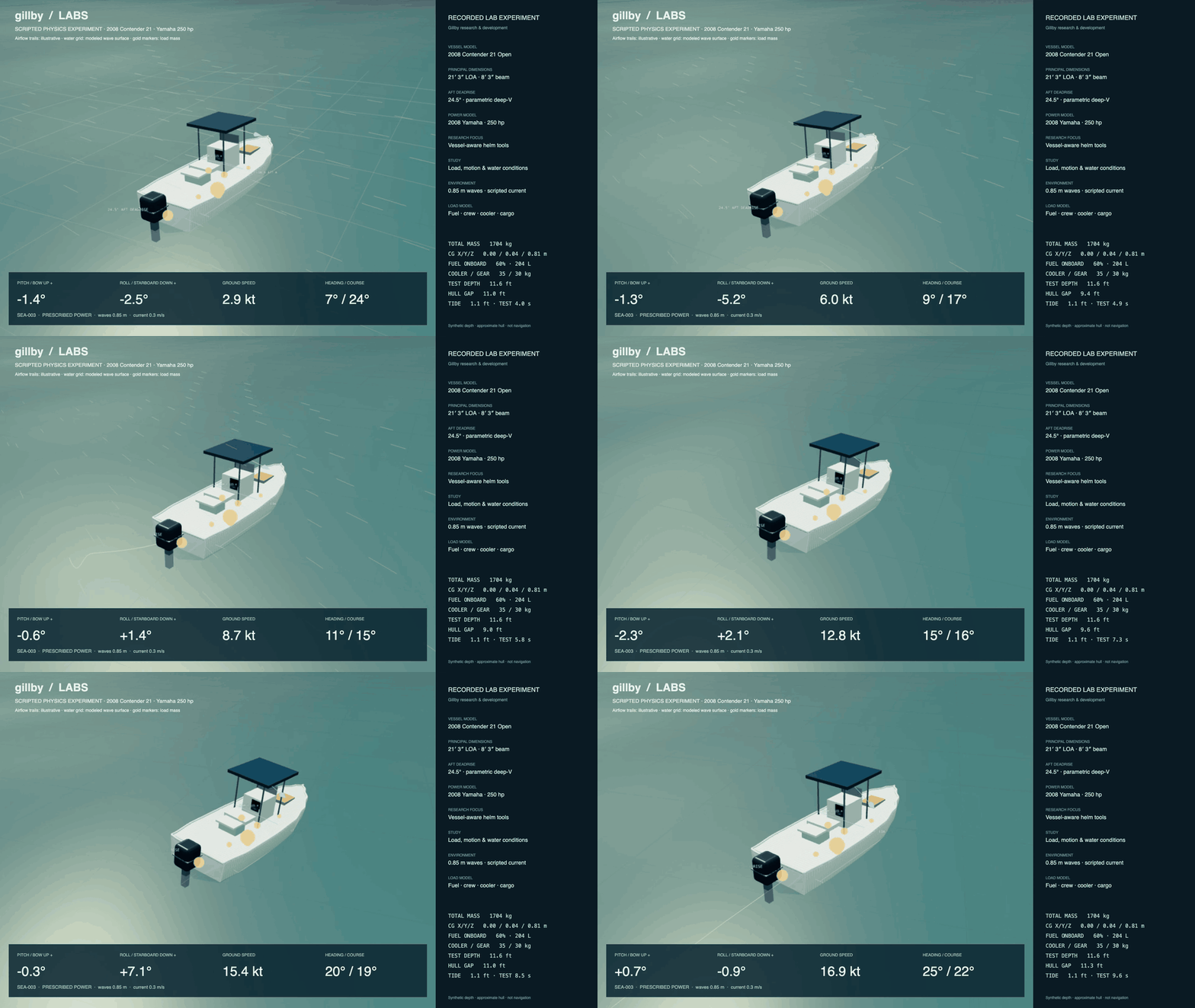
Our Contender 21 research platform brings fuel, depth, load distribution and motion into the same study. These are recorded results from our internal lab.
Simulated fuel quantity and basin depth; not live navigation readings.
THE EXPERIMENT, IN MOTION6 SECOND CAPTURE
Actual internal lab captures · synthetic test depth and tide · illustrative airflow · approximate hull physics awaiting sea-trial calibration. Fuel is modeled onboard quantity, not measured consumption.Watch the full recorded run ↗
ORIGINAL INTELLIGENCE / SELECTED WORK
Built for the conditions. Specific to your boat.
Read the water.
Choppiness, ride outlooks and activity scores.
DERIVED INTELLIGENCE
Know your margins.
Fuel estimates, tide-aware clearance and depth context.
BETA / DEVELOPMENT
Bring your boat.
196 vessel profiles across 57 makes. Custom inputs.
PERSONAL CONTEXT
Explore the research & tool catalog +
Every source is a starting point. We build the layer above it.
We’re accumulating public water data and building a growing body of derived information around it. Our contribution is the software, models, interpretation and tools that turn separate readings into something more useful—and make it accessible to people, builders and AI agents.
01 / THE FOUNDATION
Bring the public data together.
We gather and organize weather forecasts, buoy observations, tides, currents, satellite imagery, charts, river gauges and coastal records. Separate sources become a cleaner, connected view—with their origins and timestamps retained.
02 / THE ORIGINAL DATA LAYER
Build new context on top.
We develop derived scores, estimates and fields that the source feeds don’t deliver as one product: choppiness, boat-specific ride outlooks, activity ratings, forecast confidence and more. That growing layer of enriched data is part of our original work.
03 / THE PERSONAL LAYER
Make it specific to you.
A forecast means something different on a different boat. Our library contains 196 sourced boat and watercraft profiles across 57 makes, with custom vessel input when yours needs a different setup. Vessel measurements, activity preferences and confirmed inputs make the tools more personal.
04 / THE AGENTIC LAYER
Make the intelligence usable.
We expose available information through one API and MCP connection so apps and AI agents can discover places, compare conditions and help plan trips. Authorized agents can work with personal boats, saved places and trips, with permissions kept in the user’s control.
AN OPEN FOUNDATION FOR OTHERS TO BUILD ON
For builders. For classrooms. For curiosity.
We’ve released open-source MCP and skill tooling so other builders, schools, researchers and hobbyists can connect Gillby to their own ideas. Public API access, developer downloads and documented tools make that foundation easier to use.
The open-source tools sit alongside our hosted data service and original intelligence layer. Public source data stays attributed to its providers; access and reuse follow the applicable licenses and service terms.
THE DATA WE CREATE ON TOP
More than a collection of incoming feeds.
Selected scoring and enrichment work in our codebase. Availability varies by location, activity and data coverage; experimental outputs are identified as such.
Water choppiness
A dedicated chop index and descriptive water-state outlook, alongside the wind and wave readings.
Boat-specific ride outlooks
A vessel-aware interpretation of how the same conditions may feel aboard different kinds of boats.
Activity ratings
Distinct outlooks for boating, sailing, paddling, swimming, diving, inshore and offshore fishing, surfing, SUP surf and inlet conditions.
Experimental surf scores
Our own surf preference indices and session summaries. These remain experimental, with break-level quality still under study.
Rider-specific wind outlooks
Kitesurf planning that can reflect a rider’s wind range, equipment profile and launch context.
Visibility and inlet context
Derived visibility indices, tide-phase context and inlet outlooks that make local conditions easier to interpret.
Forecast refinement
Work on observation-informed near-term forecasts, localized calibration, and derived rain and thunder probability fields.
Confidence, ranges and timing
Forecast uncertainty ranges, model agreement, wave peaks, changing sea-state timing and useful activity windows.
INFORMATION THAT CAN JOIN A WORKFLOW
Ask a question. Give an agent useful tools.
A person might open the map. An app might request a forecast. An agent might compare departure windows for your authorized boat, check a proposed route and help organize a trip. We’re building the same connected information layer to support each of those experiences.
Discover a place → Read the available conditions → Apply personal context → Help with the next step
Sources, freshness and missing information travel with the result. Personal actions require authorization. Agent access to data is available independently of our future boat-operation research.
Working features, beta tools and development experiments that turn our research into practical experiences.
WORKING BETA
GPS speedometer
Measured speed over ground and GPS course, with explicit handling of weak signals, gaps and recovery.
BETA
Tide-aware bridge clearance
Bridge-height estimates with water-level context, plus comparisons to the vessel measurements you supply.
BETA / MODEL-BASED
Personalized fuel estimates
Fuel-use estimates informed by supported vessel and engine setups, confirmed horsepower, loaded weight and usable speed inputs. Estimated usage stays distinct from a tank sensor.
NATIVE + WEB DEVELOPMENT
Depth with context
Chart depth, available tide information and position quality brought into a clearer estimate. Water depth and clearance beneath a loaded, moving boat remain distinct.
BETA
Boat-aware route checks
Planning tools that bring measured draft, clearance allowances, departure timing and reported restrictions into the trip.
WORKING RESEARCH PLATFORM
A scripted vessel lab
Recorded studies of wind, chop, fuel, cargo, balance, pitch and roll, connected to our development app for repeatable experiments.
WORKING APPS / ACTIVE BETA TESTING
Already running. Getting ready for release.
iPad. iPhone. Apple Watch. Android. Working apps, in active beta testing.
Working beta builds. Public releases coming soon.
iPad
WORKING BETA
iPhone
WORKING BETA
Apple Watch
WORKING BETA
Android
WORKING BETA
20scripted scenarios
10 minsimulated test time
12,000recorded telemetry samples
One development campaign. Model behavior checks; real-boat calibration is ongoing.
RESEARCH DIRECTIONS / PLANNED EXPLORATION
Where we want to take this next.
We plan to keep experimenting wherever technology can make boating and coastal life more informed and connected.
PLANNED RESEARCH
Assisted and automated boat operation
Explore how software could support more of the work at the helm, with operator oversight and staged real-world testing.
PLANNED RESEARCH
Connections to the helm
Investigate connections with marine electronics, including systems such as Garmin and Simrad, where supported interfaces and vendor requirements allow.
PLANNED RESEARCH
Storm and hurricane forecasting research
Explore whether the observations and historical data we’re accumulating can help us develop useful storm, hurricane and local-impact forecasting tools.
PLANNED RESEARCH
King-tide and coastal flooding research
Study how high tides, observed water levels, weather and coastal geography could inform more useful local flooding outlooks, including king-tide events.
These are research ambitions, with development and validation still ahead. Storm and flood guidance continues to come from official forecasting and emergency-management agencies.
A growing intelligence layer. A practical purpose.
Our work spans data engineering, original derived fields, personal context and connected tools. Gillby Labs is a look at what we’re building and where it could lead.